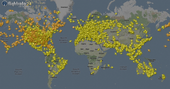
As sightings of mysterious “giant drones” over New Jersey stir up anxiety, a solution is at hand for those curious or concerned about what is flying overhead. Several apps have emerged that provide real-time data about the aircraft and unmanned drones circling the skies, helping users better understand what’s in the air at any given moment.
Aerial Confusion in New Jersey
Recent reports from New Jersey have sparked public concern, with people claiming to have seen large drones flying at night. However, government officials suggest that many of these sightings could simply be misidentifications of regular commercial flights. To clear up this confusion, apps like Flightradar24, Plane Finder, and FlightAware allow users to track real-time air traffic, including private flights, helicopters, and even unmanned aerial vehicles (UAVs) such as commercial drones.
How These Apps Work
These tracking apps provide a map of the user’s location, allowing them to see all the aircraft flying above. The apps offer details about individual flights, including altitude, speed, and destination. Users can also identify the aircraft by airline codes for commercial planes or registration numbers for private jets. The apps rely on data transmitted from aircraft to ground stations, known as ADS-B (Automatic Dependent Surveillance-Broadcast) data, as well as satellite sources.
With apps like FlightRadar24 and Plane Finder, users can even point their phone cameras at an aircraft in the sky, and the app will identify the flight in real time. This feature, similar to the popular Shazam music app, works even in low-light conditions, providing users with information about planes flying at night.
Tracking More Than 200,000 Aircraft
FlightRadar24 is one of the most popular apps in this space, tracking more than 200,000 aircraft on any given day. In fact, tracking planes has become a popular hobby for some, with a significant global audience. For instance, when a U.S. Air Force plane carrying then-House Speaker Nancy Pelosi landed in Taiwan in August 2022, over 700,000 people tuned in via FlightRadar24 to follow the event live.
What About Drones?
While these apps can track many types of aircraft, they are not foolproof. Smaller hobbyist drones, which lack the same location-transmitting technology as commercial aircraft, do not show up on these platforms. Additionally, military aircraft or high-profile flights like Air Force One are often excluded for security reasons.
Experts also note that when identifying aircraft on these apps, users might need to zoom out to get a better view of planes that are farther away than they appear to the naked eye. The apps rely on a variety of data sources, so the aircraft might be beyond the range of the user’s immediate field of view.
The Growing Interest in Air Traffic
The ability to track air traffic using these apps has generated significant interest, especially in regions where unusual sightings prompt public curiosity. Whether it’s confirming the presence of a commercial flight or tracking a mysterious drone, these apps provide a simple and accessible way for users to see what’s flying above their heads.
For anyone who’s ever wondered about an airplane or drone spotted in the sky, these apps offer an easy and fascinating way to track and identify aerial activity in real-time.


